2017 Map of Miles Ranch
USGS Topo · Published 2017About this map
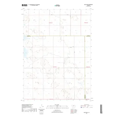
Miles Ranch sits at the intersection of several remote county lines in this rural Nebraska landscape. The map shows the convergence of Holt, Wheeler, and Garfield counties, an area characterized by scattered wetlands and small bodies of water like Chain Lake and Rush Lake. The section lines and townships, such as t24n r13w, form a strict grid over the terrain, reflected in the naming conventions of roads like 848th Rd and Dumas Ave. This 2017 survey documents a modern cattle-ranching landscape where family-named landmarks and a sparse network of gravel avenues and roads connect isolated rural sections in the Nebraska Sandhills region.
Find a feature on this map
23 named features on this map. Tap any name to fly to it.
Don’t see what you’re looking for? This feature index may not catch every label — zoom into the map to look around manually.
Map Details
Editions of this 2017 Miles Ranch Map
This is the sole edition of this map. No revisions or reprints were ever made.
Other maps of this area

1954 · Gables NW
USGS Topo · 1:24,000

1954 · Bartlett NW
USGS Topo · 1:24,000

1954 · Gables
USGS Topo · 1:24,000

1955 · Broken Bow
USGS Topo · 1:250,000

1955 · O'Neill
USGS Topo · 1:250,000

1956 · Broken Bow
USGS Topo · 1:250,000

1959 · O'Neill
USGS Topo · 1:250,000

1969 · O'Neill
USGS Topo · 1:250,000

1981 · Amelia
USGS Topo · 1:24,000

1981 · Goose Lake SW
USGS Topo · 1:24,000