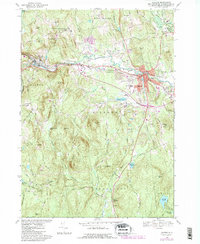
1968 Map of Milford
USGS Topo · Published 1985About this map
The Souhegan River serves as the industrial and logistical spine for this portion of Hillsborough County, flowing past the hubs of Wilton and Milford. While the valley floor is occupied by heavy infrastructure like the Boston and Maine railroad and the Milford Fish Hatchery, the surrounding hills remain defined by rural landmarks such as Curtiss Dogwood State Park and High Mowing Sch. The map reveals a post-war landscape where traditional New England town centers are flanked by newer mid-century additions like a Drive-in Theater and several trailer parks.
Find a feature on this map
74 named features on this map. Tap any name to fly to it.
Don’t see what you’re looking for? This feature index may not catch every label — zoom into the map to look around manually.
Map Details
Editions of this 1968 Milford Map
3 editions found
Other maps of this area

1887 · Fitchburg
USGS Topo · 1:62,500

1889 · Fitchburg
USGS Topo · 1:62,500

1893 · Fitchburg
USGS Topo · 1:62,500

1893 · Groton
USGS Topo · 1:62,500

1900 · Peterboro
USGS Topo · 1:62,500

1906 · Milford
USGS Topo · 1:62,500

1931 · Groton
USGS Topo · 1:48,000

1931 · Fitchburg
USGS Topo · 1:48,000

1935 · Groton
USGS Topo · 1:62,500

1935 · Fitchburg
USGS Topo · 1:62,500