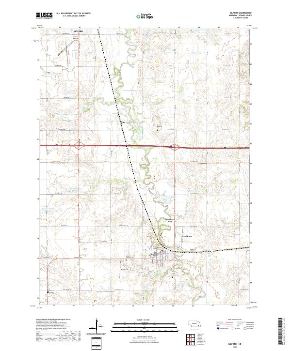
2021 Map of Milford
USGS Topo · Published 2021About this map
The Big Blue River snakes through this portion of Seward County, anchoring the town of Milford and the Riverside Park area. The landscape is a characteristic grid of Nebraska farmland, defined by a network of section roads including O Street Rd, Old Cheney Rd, and Holdredge Rd. This modern survey reveals the persistent importance of early rural centers, from the settlement at Ruby to several long-standing community spaces such as the Milford Mennonite Cem and Blue Mound Cem.
Find a feature on this map
38 named features on this map. Tap any name to fly to it.
Don’t see what you’re looking for? This feature index may not catch every label — zoom into the map to look around manually.
Map Details
Editions of this 2021 Milford Map
This is the sole edition of this map. No revisions or reprints were ever made.
Other maps of this area

1897 · Lincoln
USGS Topo · 1:125,000

1934 · Seward
USGS Topo · 1:48,000

1935 · Dorchester
USGS Topo · 1:48,000

1939 · Seward
USGS Topo · 1:62,500

1940 · Dorchester
USGS Topo · 1:62,500

1955 · Lincoln
USGS Topo · 1:250,000

1957 · Lincoln
USGS Topo · 1:250,000

1958 · Lincoln
USGS Topo · 1:250,000
1964 · Staplehurst
USGS Topo · 1:24,000
1964 · Goehner
USGS Topo · 1:24,000