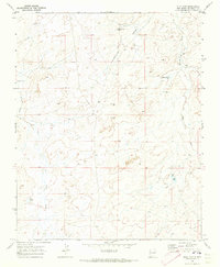
1970 Map of Milk Lake
USGS Topo · Published 1973About this map
Kim-me-ni-oli Wash and its associated valley dominate this arid stretch of McKinley County, defining a landscape where water management was central to survival and industry. During the late 1960s and early 1970s, the region supported ranching operations like the I K Ranch, while scattered infrastructure such as Windmill No 3 and Windmill No 4 provided essential resources for livestock in the high desert terrain. The drainage patterns of Indian Creek feed into ephemeral catchments like Milk Lake and Flat Lake, which appear as distinct geographic markers in an otherwise vast expanse of sage and soil. This topography is further punctuated by mineral exploration efforts, evidenced by several Drill Hole locations, indicating the geologic surveying of the era.
Find a feature on this map
12 named features on this map. Tap any name to fly to it.
Don’t see what you’re looking for? This feature index may not catch every label — zoom into the map to look around manually.
Map Details
Editions of this 1970 Milk Lake Map
2 editions found
Other maps of this area

1886 · Wingate
USGS Topo · 1:250,000

1889 · Chaco
USGS Topo · 1:250,000

1892 · Wingate
USGS Topo · 1:250,000

1892 · Chaco
USGS Topo · 1:250,000

1954 · Shiprock
USGS Topo · 1:250,000

1954 · Gallup
USGS Topo · 1:250,000

1958 · Gallup
USGS Topo · 1:250,000

1958 · Shiprock
USGS Topo · 1:250,000

1959 · Shiprock
USGS Topo · 1:250,000

1959 · Gallup
USGS Topo · 1:250,000