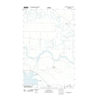
2011 Map of Milk River Hills
USGS Topo · Published 2011About this map
The Missouri River carves a massive path through this landscape, marking the confluence where the meandering Milk River joins its flow from the north. This 2011 survey captures the dramatic topography of the Milk River Hills as they rise above the northern reaches of Fort Peck Lake, specifically focusing on the area around Milk Coulee Bay. The terrain is defined by deep incisions like Ivy Coulee and Hilliard Coulee, which drain the high ground toward the river basins.
Find a feature on this map
22 named features on this map. Tap any name to fly to it.
Don’t see what you’re looking for? This feature index may not catch every label — zoom into the map to look around manually.
Map Details
Editions of this 2011 Milk River Hills Map
This is the sole edition of this map. No revisions or reprints were ever made.
Other maps of this area

1914 · Nashua
USGS Topo · 1:62,500

1915 · Frazer
USGS Topo · 1:62,500

1916 · Nashua
USGS Topo · 1:62,500

1954 · Jordan
USGS Topo · 1:250,000

1954 · Glasgow
USGS Topo · 1:250,000

1956 · Jordan
USGS Topo · 1:250,000

1957 · Glasgow
USGS Topo · 1:250,000

1958 · Glasgow
USGS Topo · 1:250,000

1958 · Jordan
USGS Topo · 1:250,000

1964 · Jordan
USGS Topo · 1:250,000