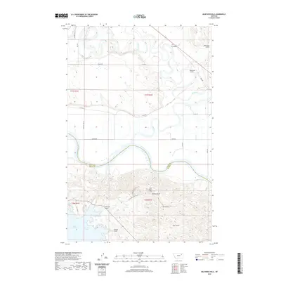
2020 Map of Milk River Hills
USGS Topo · Published 2020About this map
The Missouri River carves through the heart of this landscape, forming the boundary between Valley and McCone counties. To the north, the winding Milk River joins the Missouri after passing through a network of rural routes such as N River Rd and S River Rd. The terrain is defined by the sharp relief of the Milk River Hills, where high points like Deadman Butte overlook a series of deep drainages including Sarge Coulee, Hilliard Coulee, and Dane Coulee.
Find a feature on this map
30 named features on this map. Tap any name to fly to it.
Don’t see what you’re looking for? This feature index may not catch every label — zoom into the map to look around manually.
Map Details
Editions of this 2020 Milk River Hills Map
This is the sole edition of this map. No revisions or reprints were ever made.
Other maps of this area

1914 · Nashua
USGS Topo · 1:62,500

1915 · Frazer
USGS Topo · 1:62,500

1916 · Nashua
USGS Topo · 1:62,500

1954 · Jordan
USGS Topo · 1:250,000

1954 · Glasgow
USGS Topo · 1:250,000

1956 · Jordan
USGS Topo · 1:250,000

1957 · Glasgow
USGS Topo · 1:250,000

1958 · Glasgow
USGS Topo · 1:250,000

1958 · Jordan
USGS Topo · 1:250,000

1964 · Jordan
USGS Topo · 1:250,000