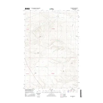
2017 Map of Milk Springs
USGS Topo · Published 2017About this map
Milk Springs anchors this high-plains landscape in Fergus County, where a network of watercourses and topographic landmarks defines the central Montana territory. The terrain is characterized by a series of prominent elevations, including Button Butte and the Three Buttes in the south, which overlook the broad expanse of Tennessee Flat. These features provided essential navigation points for early travel through the region.
Find a feature on this map
20 named features on this map. Tap any name to fly to it.
Don’t see what you’re looking for? This feature index may not catch every label — zoom into the map to look around manually.
Map Details
Editions of this 2017 Milk Springs Map
This is the sole edition of this map. No revisions or reprints were ever made.
Other maps of this area

1954 · Roundup
USGS Topo · 1:250,000

1954 · Lewistown
USGS Topo · 1:250,000

1958 · Roundup
USGS Topo · 1:250,000

1959 · Lewistown
USGS Topo · 1:250,000

1986 · Tyler
USGS Topo · 1:24,000

1986 · Snoose Creek
USGS Topo · 1:24,000

1986 · Briggs Coulee
USGS Topo · 1:24,000

1986 · Pike Creek Hills West
USGS Topo · 1:24,000

1986 · Pike Creek Hills East
USGS Topo · 1:24,000
1986 · Grass Range
USGS Topo · 1:24,000