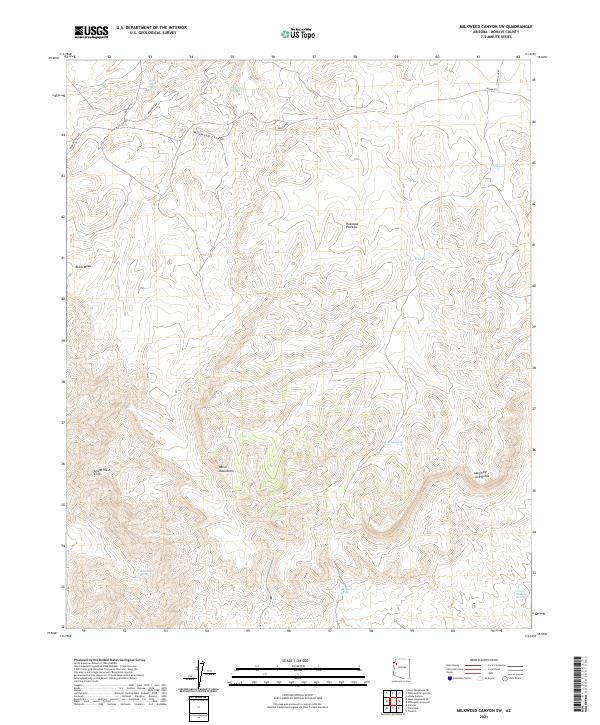
2021 Map of Milkweed Canyon SW
USGS Topo · Published 2021About this map
The Music Mountains and the dramatic Grand Wash Cliffs dominate this high-desert landscape in northwestern Arizona. This 2021 topographic record reveals a territory defined by complex verticality, where the Hualapai Plateau transitions into deep incisions like Milkweed Canyon and West Water Canyon. The scarcity of water is the primary driver of the map's nomenclature, with vital points such as Dewey Mahone Spring, Black Rock Spring, and Milkweed Spring scattered across the arid terrain. Human navigation in this remote area is primarily confined to unpaved routes like Indian Rte 1 and Milkweed Rd, which follow the natural contours of the mesas. Distinctive landmarks such as Black Mesa and Laughing Jack Butte provide essential visual orientation within this largely uninhabited stretch of Mohave County.
Find a feature on this map
25 named features on this map. Tap any name to fly to it.
Don’t see what you’re looking for? This feature index may not catch every label — zoom into the map to look around manually.
Map Details
Editions of this 2021 Milkweed Canyon SW Map
This is the sole edition of this map. No revisions or reprints were ever made.
Other maps of this area

1886 · Diamond Creek
USGS Topo · 1:250,000

1892 · Diamond Creek
USGS Topo · 1:250,000

1948 · Williams
USGS Topo · 1:250,000

1954 · Williams
USGS Topo · 1:250,000

1956 · Williams
USGS Topo · 1:250,000

1960 · Williams
USGS Topo · 1:250,000

1961 · Williams
USGS Topo · 1:250,000
1967 · Milkweed Canyon SE
USGS Topo · 1:24,000

1967 · Milkweed Canyon SW
USGS Topo · 1:24,000
1967 · Milkweed Canyon NW
USGS Topo · 1:24,000