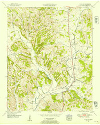
1951 Map of Milky Way
USGS Topo · Published 1954About this map
Richland Creek winds through this rural Giles County landscape, a region defined by agricultural heritage and family-named hollows. The Louisville and Nashville railroad runs parallel to the Nashville and Louisville Highway, passing through the communities of Milky Way and Bufords. These transit corridors were the lifeblood of the local economy in the early 1950s, connecting small settlements like Riversburg and Pleasant Valley to larger markets.
Find a feature on this map
66 named features on this map. Tap any name to fly to it.
Don’t see what you’re looking for? This feature index may not catch every label — zoom into the map to look around manually.
Map Details
Editions of this 1951 Milky Way Map
2 editions found
Other maps of this area

1936 · Sandy Hook
USGS Topo · 1:24,000

1936 · Milky Way
USGS Topo · 1:24,000

1936 · Campbellsville
USGS Topo · 1:24,000

1936 · Brick Church
USGS Topo · 1:24,000

1936 · Campbells Station
USGS Topo · 1:24,000

1936 · Pulaski
USGS Topo · 1:24,000

1936 · Bodenham
USGS Topo · 1:24,000

1936 · Tarpley
USGS Topo · 1:24,000

1936 · Lynnville
USGS Topo · 1:24,000

1946 · Brick Church
USGS Topo · 1:24,000