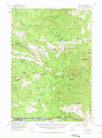
1955 Map of Mill City
USGS Topo · Published 1975About this map
The North Fork Santiam River serves as the industrial and logistical spine of this mid-1950s landscape, connecting the logging and milling communities of Mill City and Gates along the southern border. The map documents a period of significant hydraulic and timber activity, evidenced by the presence of the Big Cliff Dam and numerous resource extraction sites. Moving north from the river valley, the terrain rises into the Willamette National Forest, where the economy of the era is marked by remote outposts like the Pearl Creek Guard Sta and several active lookouts including Lookout Mtn Lookout. The rugged interior is dotted with historical mining operations, such as the Bonanza Mine, Crown Mine, and Ogle Mtn Mine, which are accessed by a network of forest roads like the Molalla Forest Road. Isolated points of interest like the Bee Ranch and the small settlement at Niagara provide evidence of early mountain habitations and small-scale river-valley development.
Find a feature on this map
96 named features on this map. Tap any name to fly to it.
Don’t see what you’re looking for? This feature index may not catch every label — zoom into the map to look around manually.
Map Details
Editions of this 1955 Mill City Map
3 editions found

Other maps of this area

1916 · Estacada
USGS Topo · 1:125,000

1929 · Mill City
USGS Topo · 1:125,000

1939 · Molalla
USGS Topo · 1:62,500

1940 · Molalla
USGS Topo · 1:62,500

1948 · Vancouver
USGS Topo · 1:250,000

1950 · Vancouver
USGS Topo · 1:250,000

1950 · Vancouver
USGS Topo · 1:250,000

1951 · Lyons
USGS Topo · 1:62,500

1951 · Snow Peak
USGS Topo · 1:62,500

1953 · Salem
USGS Topo · 1:250,000