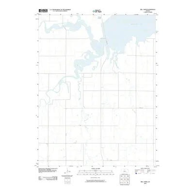
2009 Map of Mill Creek
USGS Topo · Published 2009About this map
The confluence of the North Fork Solomon River and South Fork Solomon River creates a distinctive riparian landscape dominated by the expansive Waconda Lake in the northeast. This 2009 survey shows the managed hydrology of north-central Kansas, where major waterways and smaller tributaries like Oak Creek and Carr Creek feed into this significant reservoir system. The land is organized by a strict sectional grid, with rural thoroughfares such as Tipton Rd and N Rd providing access to the agricultural hinterlands and the shoreline near Lake Dr. This map illustrates the intersection of mid-continental water management and the enduring township-and-range road patterns that define the region's geography. Researchers will find the detailed path of Mill Creek as it meanders through the eastern sections, providing a clear record of the local drainage patterns as they existed in the early twenty-first century.
Find a feature on this map
12 named features on this map. Tap any name to fly to it.
Don’t see what you’re looking for? This feature index may not catch every label — zoom into the map to look around manually.
Map Details
Editions of this 2009 Mill Creek Map
This is the sole edition of this map. No revisions or reprints were ever made.
Other maps of this area

1893 · Smith Center
USGS Topo · 1:125,000

1894 · Mankato
USGS Topo · 1:125,000

1894 · Beloit
USGS Topo · 1:125,000

1896 · Osborne
USGS Topo · 1:125,000

1953 · Downs South
USGS Topo · 1:24,000

1953 · Waconda Springs
USGS Topo · 1:24,000

1953 · Glen Elder South
USGS Topo · 1:24,000

1955 · Beloit
USGS Topo · 1:250,000

1959 · Beloit
USGS Topo · 1:250,000

1960 · Downs North
USGS Topo · 1:24,000