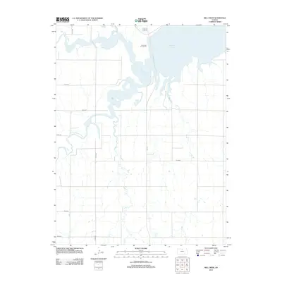
2012 Map of Mill Creek
USGS Topo · Published 2012About this map
Waconda Lake dominates the northern reaches of this Osborne County landscape, where the confluence of the N Fork Solomon River and the S Fork Solomon River defines the local drainage. The terrain is marked by a network of drainage systems, including the meandering paths of Oak Cr and the map's namesake, Mill Cr. Cultural landmarks are centered primarily on the upland plateaus between these waterways, notably the Saints Peter and Paul Cem situated near the lake's southwestern shore. The section-line road network, including Tipton Rd and Lake Dr, reveals a strictly organized agricultural grid that persists despite the complex hydrology of the river forks and the encroachment of the reservoir's fingers.
Find a feature on this map
15 named features on this map. Tap any name to fly to it.
Don’t see what you’re looking for? This feature index may not catch every label — zoom into the map to look around manually.
Map Details
Editions of this 2012 Mill Creek Map
This is the sole edition of this map. No revisions or reprints were ever made.
Other maps of this area

1893 · Smith Center
USGS Topo · 1:125,000

1894 · Mankato
USGS Topo · 1:125,000

1894 · Beloit
USGS Topo · 1:125,000

1896 · Osborne
USGS Topo · 1:125,000

1953 · Downs South
USGS Topo · 1:24,000

1953 · Waconda Springs
USGS Topo · 1:24,000

1953 · Glen Elder South
USGS Topo · 1:24,000

1955 · Beloit
USGS Topo · 1:250,000

1959 · Beloit
USGS Topo · 1:250,000

1960 · Downs North
USGS Topo · 1:24,000