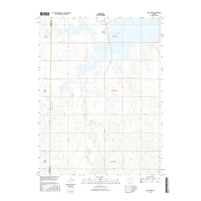
2015 Map of Mill Creek
USGS Topo · Published 2015About this map
Waconda Lake dominates the northern reaches of this Osborne and Mitchell County landscape, where the waters of the South Fork Solomon River and Carr Cr converge. This 2015 study captures the modern topography of a region defined by its hydrography and a strict grid of section-line roads, including Tipton Rd and James Trl. The map preserves the location of the Saints Peter and Paul Cem overlooking the lake's western arm. A unique cultural and geologic landmark, the Great Spirit Spring, is noted in the northeastern corner near the Mitchell County line. To the south, the terrain transitions into the drainage basin of Mill Cr, which winds through the agricultural plains that characterize the central Kansas section of the Smoky Hills region.
Find a feature on this map
35 named features on this map. Tap any name to fly to it.
Don’t see what you’re looking for? This feature index may not catch every label — zoom into the map to look around manually.
Map Details
Editions of this 2015 Mill Creek Map
This is the sole edition of this map. No revisions or reprints were ever made.
Other maps of this area

1893 · Smith Center
USGS Topo · 1:125,000

1894 · Mankato
USGS Topo · 1:125,000

1894 · Beloit
USGS Topo · 1:125,000

1896 · Osborne
USGS Topo · 1:125,000

1953 · Downs South
USGS Topo · 1:24,000

1953 · Waconda Springs
USGS Topo · 1:24,000

1953 · Glen Elder South
USGS Topo · 1:24,000

1955 · Beloit
USGS Topo · 1:250,000

1959 · Beloit
USGS Topo · 1:250,000

1960 · Downs North
USGS Topo · 1:24,000