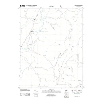
2011 Map of Mill Creek
USGS Topo · Published 2011About this map
The Tygart Valley River anchors this high-elevation landscape, winding northward through the valley floor where the settlements of Mill Creek and Huttonsville are situated. This 2011 survey captures the area's transition from the river basin into the steep terrain of the Allegheny Mountains, dominated by high points like Hutton Knob and Chestnut Ridge. For local history researchers, the Old Brick Church Cemetery is a significant landmark located along the valley road south of Huttonsville, serving as a focal point for the early settlement history of Randolph County. Numerous watercourses, including Shavers Run, Riffle Creek, and Becky Creek, drain the surrounding ridges, illustrating the complex hydrology that influenced original road placements and homesteading. The map details a network of rural routes such as Mill Creek Rd and Channel Rd that follow the natural contours of the land, connecting the valley communities to the more remote heights of Cromer Top and White Top.
Find a feature on this map
46 named features on this map. Tap any name to fly to it.
Don’t see what you’re looking for? This feature index may not catch every label — zoom into the map to look around manually.
Map Details
Editions of this 2011 Mill Creek Map
This is the sole edition of this map. No revisions or reprints were ever made.
Other maps of this area

1889 · Beverly
USGS Topo · 1:125,000

1892 · Beverly
USGS Topo · 1:125,000

1893 · Buckhannon
USGS Topo · 1:125,000

1896 · Buckhannon
USGS Topo · 1:125,000

1897 · Buckhannon
USGS Topo · 1:125,000

1909 · Elkins
USGS Topo · 1:62,500

1912 · Sago
USGS Topo · 1:48,000

1913 · Pickens
USGS Topo · 1:48,000

1914 · Sago
USGS Topo · 1:62,500

1915 · Pickens
USGS Topo · 1:62,500