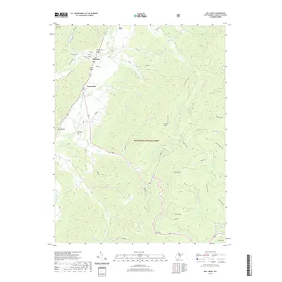
2019 Map of Mill Creek
USGS Topo · Published 2019About this map
Mill Creek and Huttonsville sit along the winding Tygart Valley River as it passes through this portion of the Monongahela National Forest. The landscape is dominated by high ridges, including Rich Mtn to the west and the expansive Cheat Mtn and Chestnut Ridge to the east. The river valley serves as the primary corridor for human activity, connected by the WM Currence Memorial Bridge and historically significant landmarks such as the Old Brick Church Cem. Numerous small waterways like Becky Cr, Riffle Cr, and Shavers Run carve through the forested uplands, flowing from high points like Hutton Knob and Cromer Top. This terrain reflects the deep-cut valleys and sharp relief characteristic of the Allegheny Mountains, where settlement is tightly clustered in the limited flat land of the river bottoms.
Find a feature on this map
50 named features on this map. Tap any name to fly to it.
Don’t see what you’re looking for? This feature index may not catch every label — zoom into the map to look around manually.
Map Details
Editions of this 2019 Mill Creek Map
This is the sole edition of this map. No revisions or reprints were ever made.
Other maps of this area

1889 · Beverly
USGS Topo · 1:125,000

1892 · Beverly
USGS Topo · 1:125,000

1893 · Buckhannon
USGS Topo · 1:125,000

1896 · Buckhannon
USGS Topo · 1:125,000

1897 · Buckhannon
USGS Topo · 1:125,000

1909 · Elkins
USGS Topo · 1:62,500

1912 · Sago
USGS Topo · 1:48,000

1913 · Pickens
USGS Topo · 1:48,000

1914 · Sago
USGS Topo · 1:62,500

1915 · Pickens
USGS Topo · 1:62,500