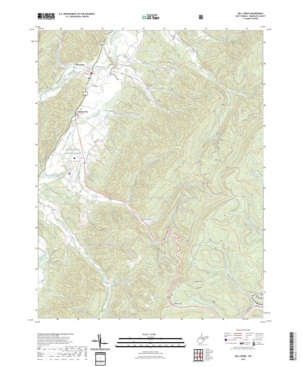
2023 Map of Mill Creek
USGS Topo · Published 2023About this map
The Tygart Valley River carves through the landscape of Randolph County in this 2023 edition, defining a fertile corridor between the high peaks of Rich Mountain and Cheat Mountain. This area is anchored by the long-established settlements of Huttonsville and Mill Creek, where residential blocks are organized along streets like Conrad St and Mill St. The map illustrates a rural society built on the narrow strips of level ground within the Tygart Valley, transitioning quickly into the protected wilderness of the Monongahela National Forest. Significant local history is preserved at the Old Brick Church Cem along Riffle Creek, a landmark that predates the modern road network. Higher elevations are dominated by timber and ridge-line trails, including the Chestnut Ridge Trl and Stonecoal Ridge Trl, connecting prominent summits like Hutton Knob and Cromer Top.
Find a feature on this map
48 named features on this map. Tap any name to fly to it.
Don’t see what you’re looking for? This feature index may not catch every label — zoom into the map to look around manually.
Map Details
Editions of this 2023 Mill Creek Map
This is the sole edition of this map. No revisions or reprints were ever made.
Other maps of this area

1889 · Beverly
USGS Topo · 1:125,000

1892 · Beverly
USGS Topo · 1:125,000

1893 · Buckhannon
USGS Topo · 1:125,000

1896 · Buckhannon
USGS Topo · 1:125,000

1897 · Buckhannon
USGS Topo · 1:125,000

1909 · Elkins
USGS Topo · 1:62,500

1912 · Sago
USGS Topo · 1:48,000

1913 · Pickens
USGS Topo · 1:48,000

1914 · Sago
USGS Topo · 1:62,500

1915 · Pickens
USGS Topo · 1:62,500