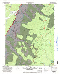
1995 Map of Mill Creek
USGS Topo · Published 1998About this map
The Tygart Valley River flows through a broad agricultural valley flanked by the steep elevations of Rich Mountain and Cheat Mountain. This mid-1990s record of Randolph County highlights the concentrated settlements of Mill Creek and Huttonsville, where the valley's level terrain supports critical infrastructure including the Huttonsville Correctional Center and the Tygart Valley High School. The mapping of the Monongahela National Forest boundary reveals a sharp contrast between the valley's developed riverbanks and the forested uplands of Chestnut Ridge.
Find a feature on this map
54 named features on this map. Tap any name to fly to it.
Don’t see what you’re looking for? This feature index may not catch every label — zoom into the map to look around manually.
Map Details
Editions of this 1995 Mill Creek Map
This is the sole edition of this map. No revisions or reprints were ever made.
Other maps of this area

1889 · Beverly
USGS Topo · 1:125,000

1892 · Beverly
USGS Topo · 1:125,000

1893 · Buckhannon
USGS Topo · 1:125,000

1896 · Buckhannon
USGS Topo · 1:125,000

1897 · Buckhannon
USGS Topo · 1:125,000

1909 · Elkins
USGS Topo · 1:62,500

1912 · Sago
USGS Topo · 1:48,000

1913 · Pickens
USGS Topo · 1:48,000

1914 · Sago
USGS Topo · 1:62,500

1915 · Pickens
USGS Topo · 1:62,500