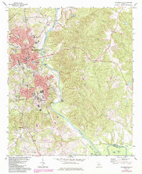
1972 Map of Milledgeville
USGS Topo · Published 1984About this map
Milledgeville serves as a major institutional hub during the early 1970s, defined by the expansive grounds of the Central State Hospital and the dual campuses of Georgia College and Georgia Military College. The city's layout is deeply intertwined with the Oconee River, which features several named landforms like Buzzard Island and McMillan Island. This era shows a community balanced between public service institutions and industrial logistics, with the Central of Georgia and Seaboard Coast Line railroads facilitating movement through the region.
Find a feature on this map
51 named features on this map. Tap any name to fly to it.
Don’t see what you’re looking for? This feature index may not catch every label — zoom into the map to look around manually.
Map Details
Editions of this 1972 Milledgeville Map
3 editions found
Other maps of this area

1912 · Milledgeville
USGS Topo · 1:62,500

1916 · Irwinton
USGS Topo · 1:62,500

1920 · Irwinton
USGS Topo · 1:62,500

1953 · Athens
USGS Topo · 1:250,000

1956 · Gordon
USGS Topo · 1:62,500

1957 · Macon
USGS Topo · 1:250,000

1958 · Macon
USGS Topo · 1:250,000

1958 · Athens
USGS Topo · 1:250,000

1959 · Athens
USGS Topo · 1:250,000

1963 · Athens
USGS Topo · 1:250,000