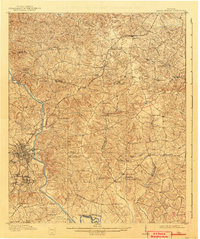
1912 Map of Milledgeville
USGS Topo · Published 1942About this map
The Oconee River flows past the established city of Milledgeville in this survey based on data from 1909. The landscape is defined by a dense network of rural churches and schools that served the agricultural community of Baldwin County. Significant institutional landmarks like the State Sanitarium sit south of the city center, while smaller hamlets like Devereux and Carrs Station are connected by the Georgia RR.
Find a feature on this map
60 named features on this map. Tap any name to fly to it.
Don’t see what you’re looking for? This feature index may not catch every label — zoom into the map to look around manually.
Map Details
Editions of this 1912 Milledgeville Map
3 editions found
Other maps of this area

1912 · Milledgeville
USGS Topo · 1:62,500

1916 · Irwinton
USGS Topo · 1:62,500

1920 · Irwinton
USGS Topo · 1:62,500

1953 · Athens
USGS Topo · 1:250,000

1956 · Gordon
USGS Topo · 1:62,500

1957 · Macon
USGS Topo · 1:250,000

1958 · Macon
USGS Topo · 1:250,000

1958 · Athens
USGS Topo · 1:250,000

1959 · Athens
USGS Topo · 1:250,000

1961 · Deepstep
USGS Topo · 1:24,000