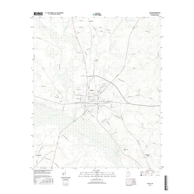
2017 Map of Millen
USGS Topo · Published 2017About this map
The town of Millen serves as the central hub for this Jenkins County landscape, situated at a crossroads of rail and river geography. The Central of Georgia RR corridor bisects the terrain, tracing a path through the lowland basins of Buckhead Creek and the Ogeechee River. This 2017 survey reflects a rural Georgia community defined by its topography, where settlements like Lawton and Emmalane are bordered by the rise of Sandy Ridge and Paramore Hill. Local genealogy and land use are preserved through the locations of the Little Buckhead Cem and Lane Cem, while the intricate network of tributaries such as Oak Cane Br and Spring Mill Br illustrates the hydrologic character of the Coastal Plain. The proximity of named waterways like Davis Lake and Millen View Lake underscores the importance of local water resources in this agricultural and timber-rich region.
Find a feature on this map
98 named features on this map. Tap any name to fly to it.
Don’t see what you’re looking for? This feature index may not catch every label — zoom into the map to look around manually.
Map Details
Editions of this 2017 Millen Map
This is the sole edition of this map. No revisions or reprints were ever made.
Other maps of this area

1920 · Millen
USGS Topo · 1:62,500

1921 · Rocky Ford
USGS Topo · 1:62,500

1943 · Rocky Ford
USGS Topo · 1:62,500

1943 · Millen
USGS Topo · 1:62,500

1943 · Millen
USGS Topo · 1:125,000

1947 · Savannah
USGS Topo · 1:250,000

1948 · Savannah
USGS Topo · 1:250,000

1957 · Macon
USGS Topo · 1:250,000

1957 · Savannah
USGS Topo · 1:250,000

1958 · Macon
USGS Topo · 1:250,000