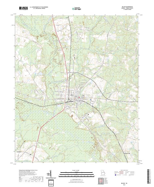
2024 Map of Millen
USGS Topo · Published 2024About this map
Millen serves as the focal point of this Jenkins County landscape, anchored by the Jenkins County Courthouse and a transportation network defined by the Central of Georgia Ave rail corridor. The town sits at a geographic crossroads where several significant waterways converge, including Buckhead Creek and Little Buckhead Creek, which wind through the terrain before meeting the Ogeechee River to the south. The surrounding countryside is dotted with established landmarks that speak to the area's long-standing community roots, such as the Little Buckhead Cem north of town and Lane Cem near the settlement of Emmalane. To the northeast, the topography rises toward Sandy Ridge and Honey Ridge, while the southern reaches are marked by the prominence of Paramore Hill. The map detail captures a transition between the organized street grid of the county seat and the outlying rural reaches like Lawton, providing a clear view of how the local economy follows the lines of the river and rail.
Find a feature on this map
100 named features on this map. Tap any name to fly to it.
Don’t see what you’re looking for? This feature index may not catch every label — zoom into the map to look around manually.
Map Details
Editions of this 2024 Millen Map
This is the sole edition of this map. No revisions or reprints were ever made.
Other maps of this area

1920 · Millen
USGS Topo · 1:62,500

1921 · Rocky Ford
USGS Topo · 1:62,500

1943 · Rocky Ford
USGS Topo · 1:62,500

1943 · Millen
USGS Topo · 1:62,500

1943 · Millen
USGS Topo · 1:125,000

1947 · Savannah
USGS Topo · 1:250,000

1948 · Savannah
USGS Topo · 1:250,000

1957 · Macon
USGS Topo · 1:250,000

1957 · Savannah
USGS Topo · 1:250,000

1958 · Macon
USGS Topo · 1:250,000