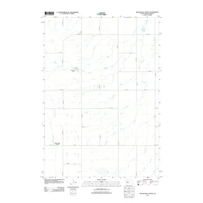
2012 Map of Miller Dale Colony
USGS Topo · Published 2012About this map
Miller Dale Colony serves as a primary point of interest in this Hand County landscape, where the prairie is defined by a strict section-line road grid and the meandering path of Ree Cr. This 2012 USGS study illustrates a region where land use is predominantly agricultural, with the natural drainage of Campbell Gulch providing one of the few breaks in the geometric surveying of the plains. To the north, Camp Da-Ko-Ta sits near the upper reaches of the creek, highlighting the sparse but deliberate placement of social and communal sites across the rural expanse. The map details the local infrastructure of the early 21st century, from the primary thoroughfare of 354th Ave to the numerous secondary roads like 200th St and 206th St that connect the isolated settlements and farmsteads.
Find a feature on this map
18 named features on this map. Tap any name to fly to it.
Don’t see what you’re looking for? This feature index may not catch every label — zoom into the map to look around manually.
Map Details
Editions of this 2012 Miller Dale Colony Map
This is the sole edition of this map. No revisions or reprints were ever made.
Other maps of this area

1899 · Redfield
USGS Topo · 1:125,000

1949 · Vayland SW
USGS Topo · 1:24,000

1950 · Ree Heights SE
USGS Topo · 1:24,000

1950 · Vayland NW
USGS Topo · 1:24,000

1950 · Ree Heights
USGS Topo · 1:24,000

1951 · Vayland SW
USGS Topo · 1:24,000

1953 · Huron
USGS Topo · 1:250,000

1954 · Huron
USGS Topo · 1:250,000

1967 · Miller
USGS Topo · 1:24,000

1973 · Ames
USGS Topo · 1:24,000