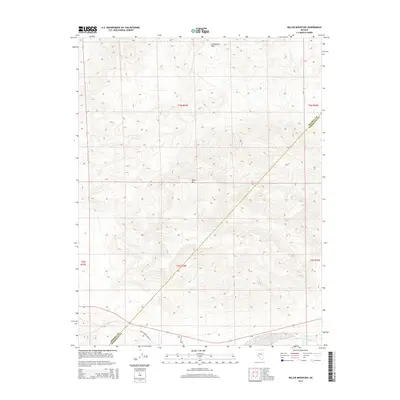
2014 Map of Miller Mountain
USGS Topo · Published 2014About this map
Miller Mtn and the surrounding Candelaria Hills dominate this high-desert landscape in the western Great Basin. This 2014 survey captures a sparsely populated region defined by its complex topography and the border between Mineral and Esmeralda counties. The presence of Gree Company Mine Rd in the southern portion of the sheet points to the ongoing importance of access to remote mineral resources in this part of Nevada. While water is scarce, Pinchot Cr is marked in the southeastern corner, highlighting one of the few named drainage features in an otherwise arid basin-and-range environment. The map provides a precise look at the township and range survey lines, including t3n r34e and t2n r34e, which organize this vast public land area.
Find a feature on this map
10 named features on this map. Tap any name to fly to it.
Don’t see what you’re looking for? This feature index may not catch every label — zoom into the map to look around manually.
Map Details
Editions of this 2014 Miller Mountain Map
This is the sole edition of this map. No revisions or reprints were ever made.
Other maps of this area

1909 · Hawthorne
USGS Topo · 1:250,000

1911 · Hawthorne
USGS Topo · 1:250,000

1915 · Hawthorne
USGS Topo · 1:250,000

1917 · White Mountain
USGS Topo · 1:125,000

1947 · Mariposa
USGS Topo · 1:250,000

1948 · Walker Lake
USGS Topo · 1:250,000

1948 · Mariposa
USGS Topo · 1:250,000

1957 · Walker Lake
USGS Topo · 1:250,000

1957 · Mariposa
USGS Topo · 1:250,000

1962 · Walker Lake
USGS Topo · 1:250,000