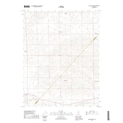
2018 Map of Miller Mountain
USGS Topo · Published 2018About this map
Miller Mountain dominates the center of this high-desert landscape in Esmeralda County, standing as a prominent landmark between the Candelaria Hills to the north and the lower basins to the south. This 2018 survey documents a remote and arid portion of the Nevada interior, where the county line between Mineral and Esmeralda counties cuts diagonally across the rugged terrain. The survey highlights a sparse drainage network, most notably the seasonal flow of Pinchot Creek, which runs along the southern boundary. This map is particularly useful for understanding the complex topography of the Great Basin, where isolated peaks and dry creek beds like Pinchot Creek define the navigation and settlement patterns of the region.
Find a feature on this map
11 named features on this map. Tap any name to fly to it.
Don’t see what you’re looking for? This feature index may not catch every label — zoom into the map to look around manually.
Map Details
Editions of this 2018 Miller Mountain Map
This is the sole edition of this map. No revisions or reprints were ever made.
Other maps of this area

1909 · Hawthorne
USGS Topo · 1:250,000

1911 · Hawthorne
USGS Topo · 1:250,000

1915 · Hawthorne
USGS Topo · 1:250,000

1917 · White Mountain
USGS Topo · 1:125,000

1947 · Mariposa
USGS Topo · 1:250,000

1948 · Walker Lake
USGS Topo · 1:250,000

1948 · Mariposa
USGS Topo · 1:250,000

1957 · Walker Lake
USGS Topo · 1:250,000

1957 · Mariposa
USGS Topo · 1:250,000

1962 · Walker Lake
USGS Topo · 1:250,000