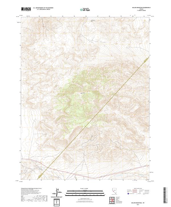
2021 Map of Miller Mountain
USGS Topo · Published 2021About this map
Miller Mtn rises as the central geographic focus of this 2021 survey, situated along the boundary between Mineral Co and Esmeralda Co. The landscape is dominated by the high-elevation terrain of the Candelaria Hills, which stretch across the northern sections of the quadrangle. In the southern portion of the map, the ephemeral drainage of Pinchot Creek (labeled also as Pinchot Cr) marks the valley floor before the land climbs toward the higher ridges. This map illustrates a high-desert environment defined by elevation and administrative lines, showing how the township and range system partitions the remote terrain near the county line. The absence of major settlements highlights the area's isolation and its character as a region of significant topographic relief and water scarcity.
Find a feature on this map
11 named features on this map. Tap any name to fly to it.
Don’t see what you’re looking for? This feature index may not catch every label — zoom into the map to look around manually.
Map Details
Editions of this 2021 Miller Mountain Map
This is the sole edition of this map. No revisions or reprints were ever made.
Other maps of this area

1909 · Hawthorne
USGS Topo · 1:250,000

1911 · Hawthorne
USGS Topo · 1:250,000

1915 · Hawthorne
USGS Topo · 1:250,000

1917 · White Mountain
USGS Topo · 1:125,000

1947 · Mariposa
USGS Topo · 1:250,000

1948 · Walker Lake
USGS Topo · 1:250,000

1948 · Mariposa
USGS Topo · 1:250,000

1957 · Walker Lake
USGS Topo · 1:250,000

1957 · Mariposa
USGS Topo · 1:250,000

1962 · Walker Lake
USGS Topo · 1:250,000