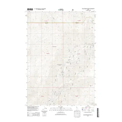
2013 Map of Miller Mountain West
USGS Topo · Published 2013About this map
Boise National Forest dominates this high-country landscape at the boundary of Valley and Boise Counties. The terrain is defined by the prominent Deadwood Ridge and the heights of Miller Mtn, creating a complex network of drainage basins. Numerous named watercourses, including Whitehawk Cr and O'Keefe Cr, carve through the steep topography. This 2013 survey illustrates the modern configuration of Forest Service access, featuring Clear Creek Rd and Bear Valley Rd. The map serves as a detailed record of the drainage patterns and ridge systems that dictate travel and land use in this part of the Idaho backcountry, showing how Nat For Dev Rd 515 and other corridors navigate the elevation changes between t11n r8e and t9n r7e.
Find a feature on this map
35 named features on this map. Tap any name to fly to it.
Don’t see what you’re looking for? This feature index may not catch every label — zoom into the map to look around manually.
Map Details
Editions of this 2013 Miller Mountain West Map
This is the sole edition of this map. No revisions or reprints were ever made.
Other maps of this area

1891 · Bear Valley
USGS Topo · 1:125,000

1893 · Bear Valley
USGS Topo · 1:125,000

1909 · Garden Valley
USGS Topo · 1:125,000

1953 · Deadwood Reservoir
USGS Topo · 1:62,500

1957 · Challis
USGS Topo · 1:250,000

1960 · Challis
USGS Topo · 1:250,000

1963 · Challis
USGS Topo · 1:250,000

1972 · Cache Creek
USGS Topo · 1:24,000
1972 · Miller Mtn East
USGS Topo · 1:24,000

1972 · Scott Creek
USGS Topo · 1:24,000