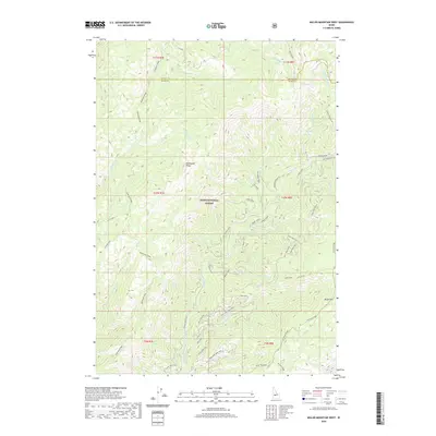
2020 Map of Miller Mountain West
USGS Topo · Published 2020About this map
Boise National Forest land dominates this high-elevation terrain where the boundary of Valley and Boise counties meets. The landscape is defined by the massive spine of Deadwood Ridge, which runs through the western half of the map, and the prominent peaks of Miller Mountain and Red Mountain to the southeast and east. The hydrology of the area is complex, with numerous drainage systems like Okeefe Creek, Big Spruce Creek, and Long Creek carving out steep canyons between the ridges.
Find a feature on this map
58 named features on this map. Tap any name to fly to it.
Don’t see what you’re looking for? This feature index may not catch every label — zoom into the map to look around manually.
Map Details
Editions of this 2020 Miller Mountain West Map
This is the sole edition of this map. No revisions or reprints were ever made.
Other maps of this area

1891 · Bear Valley
USGS Topo · 1:125,000

1893 · Bear Valley
USGS Topo · 1:125,000

1909 · Garden Valley
USGS Topo · 1:125,000

1953 · Deadwood Reservoir
USGS Topo · 1:62,500

1957 · Challis
USGS Topo · 1:250,000

1960 · Challis
USGS Topo · 1:250,000

1963 · Challis
USGS Topo · 1:250,000

1972 · Cache Creek
USGS Topo · 1:24,000
1972 · Miller Mtn East
USGS Topo · 1:24,000

1972 · Scott Creek
USGS Topo · 1:24,000