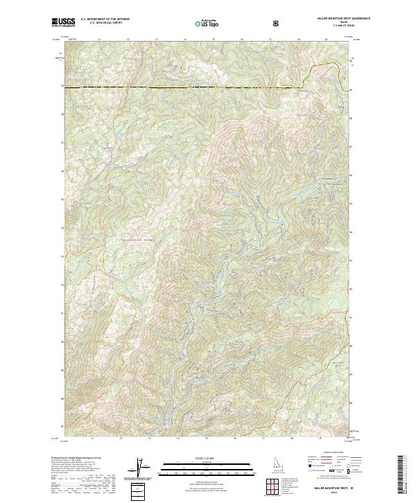
2024 Map of Miller Mountain West
USGS Topo · Published 2024About this map
Boise National Forest encompasses this high-elevation landscape along the border of Valley and Boise Counties. The terrain is defined by prominent rises like Deadwood Ridge and Miller Mtn, which serve as the headwaters for a dense network of drainages including Whitehawk Creek, No Man Creek, and Big Spruce Creek. This 2024 survey documents the complex system of forest routes that provide access through the backcountry, including the Kirkham Ridge Trl and Deadwood Ridge Trl.
Find a feature on this map
37 named features on this map. Tap any name to fly to it.
Don’t see what you’re looking for? This feature index may not catch every label — zoom into the map to look around manually.
Map Details
Editions of this 2024 Miller Mountain West Map
This is the sole edition of this map. No revisions or reprints were ever made.
Other maps of this area

1891 · Bear Valley
USGS Topo · 1:125,000

1893 · Bear Valley
USGS Topo · 1:125,000

1909 · Garden Valley
USGS Topo · 1:125,000

1953 · Deadwood Reservoir
USGS Topo · 1:62,500

1957 · Challis
USGS Topo · 1:250,000

1960 · Challis
USGS Topo · 1:250,000

1963 · Challis
USGS Topo · 1:250,000

1972 · Cache Creek
USGS Topo · 1:24,000
1972 · Miller Mtn East
USGS Topo · 1:24,000

1972 · Scott Creek
USGS Topo · 1:24,000