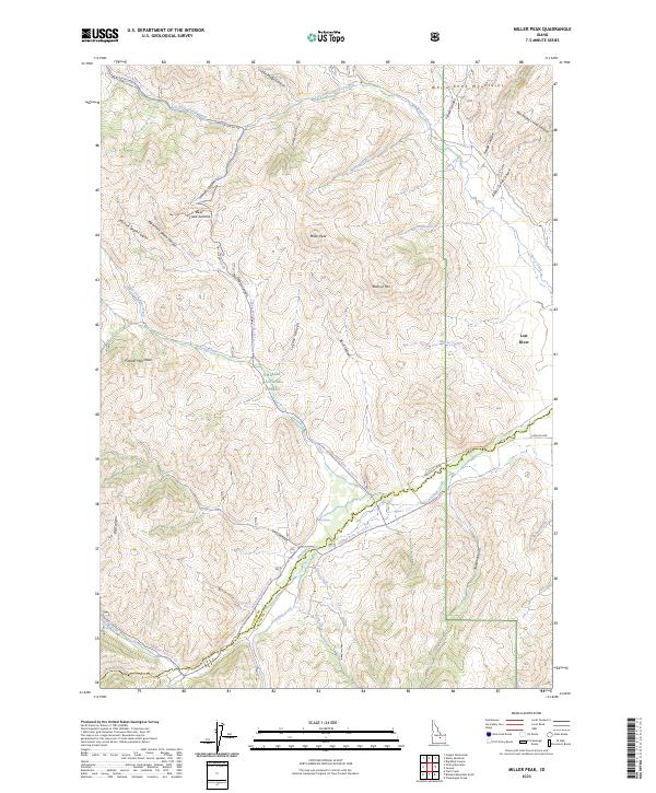
2023 Map of Miller Peak
USGS Topo · Published 2023About this map
The White Knob Mountains dominate this high-elevation terrain within the Challis National Forest, where the complex drainage systems of the Pioneer Mountains converge. The landscape is defined by deep incisions like Death Canyon and Larkspur Canyon, and prominent high points including Miller Peak and Reserve Mtn. A network of forest routes, such as the Cherry Creek Summit Rd and the Copper Basin Road - Fr 135 Trl, provide access through the mountain passes and connect historical grazing areas. The county boundary between Custer and Butte counties runs through the southern section of the quadrangle, following the rugged topography near Big Spring and the headwaters of Antelope Creek. This modern survey highlights the persistent remote character of this part of Idaho, where named features like the Flower Garden and Box Bailey Corral Canyon reflect a history of localized land use and surveying.
Find a feature on this map
49 named features on this map. Tap any name to fly to it.
Don’t see what you’re looking for? This feature index may not catch every label — zoom into the map to look around manually.
Map Details
Editions of this 2023 Miller Peak Map
This is the sole edition of this map. No revisions or reprints were ever made.
Other maps of this area

1935 · MacKay
USGS Topo · 1:96,000

1940 · Mackay
USGS Topo · 1:62,500

1955 · Idaho Falls
USGS Topo · 1:250,000

1958 · Idaho Falls
USGS Topo · 1:250,000

1960 · Muldoon Canyon
USGS Topo · 1:62,500

1960 · Grouse
USGS Topo · 1:62,500

1960 · Mackay
USGS Topo · 1:62,500

1960 · Copper Basin
USGS Topo · 1:62,500
1988 · Arco
USGS Topo · 1:100,000
1991 · Trail Creek
USGS Topo · 1:24,000