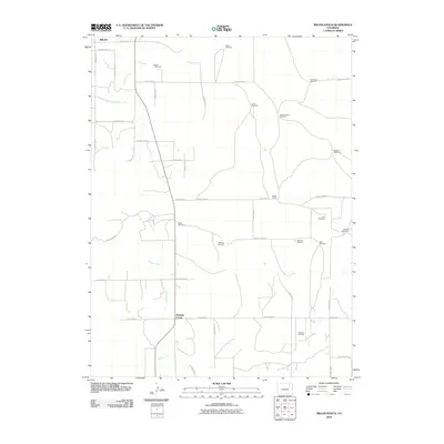
2010 Map of Miller Ranch
USGS Topo · Published 2010About this map
Beaver Creek meanders through this agricultural landscape south of Brush, Colorado, where a network of irrigation works like the Fort Morgan Canal and the Upper Platte and Beaver Canal sustain the high plains terrain. The map documents an area defined by large-scale ranching and resource extraction, anchored by Miller Ranch and the Zorichak Oil Field. This survey provides a precise record of rural property and utility, noting specific locations for water infrastructure such as the Moreland, Atkinson, and Mitchell Windmills.
Find a feature on this map
39 named features on this map. Tap any name to fly to it.
Don’t see what you’re looking for? This feature index may not catch every label — zoom into the map to look around manually.
Map Details
Editions of this 2010 Miller Ranch Map
This is the sole edition of this map. No revisions or reprints were ever made.
Other maps of this area

1951 · Brush West
USGS Topo · 1:24,000

1951 · Merino SW
USGS Topo · 1:24,000

1951 · Brush East
USGS Topo · 1:24,000

1954 · Sterling
USGS Topo · 1:250,000

1958 · Sterling
USGS Topo · 1:250,000

1963 · Round Top
USGS Topo · 1:24,000

1965 · Gary
USGS Topo · 1:24,000

1965 · Huey Ranch
USGS Topo · 1:24,000

1965 · Miller Ranch
USGS Topo · 1:24,000

1971 · Brush East
USGS Topo · 1:24,000