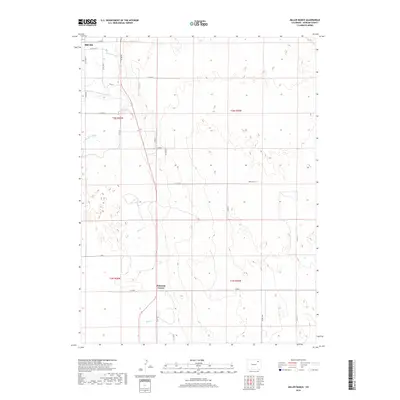
2019 Map of Miller Ranch
USGS Topo · Published 2019About this map
Miller Ranch and the open plains of Morgan County define this section of the Colorado landscape, where water management is central to the area's layout. The northern edge of the map features the outskirts of Brush, where suburban streets give way to a grid of rural roads. The hydrological network is dominated by the course of Beaver Cr, which is supported by early 21st-century irrigation infrastructure including the Upper Platte and Beaver Canal and the Fort Morgan Canal. These canals reflect the long-standing agricultural dependence on diverted water in the High Plains. Smaller intersections like Ninemile Corner punctuate the vast sections of land, which are organized according to the Public Land Survey System as shown by the prominent township markers for t3n r55w and t2n r56w. The layout reveals a landscape dedicated to ranching and farming, with a regular network of county roads providing access to isolated homesteads and field operations.
Find a feature on this map
30 named features on this map. Tap any name to fly to it.
Don’t see what you’re looking for? This feature index may not catch every label — zoom into the map to look around manually.
Map Details
Editions of this 2019 Miller Ranch Map
This is the sole edition of this map. No revisions or reprints were ever made.
Other maps of this area

1951 · Brush West
USGS Topo · 1:24,000

1951 · Merino SW
USGS Topo · 1:24,000

1951 · Brush East
USGS Topo · 1:24,000

1954 · Sterling
USGS Topo · 1:250,000

1958 · Sterling
USGS Topo · 1:250,000

1963 · Round Top
USGS Topo · 1:24,000

1965 · Gary
USGS Topo · 1:24,000

1965 · Huey Ranch
USGS Topo · 1:24,000

1965 · Miller Ranch
USGS Topo · 1:24,000

1971 · Brush East
USGS Topo · 1:24,000