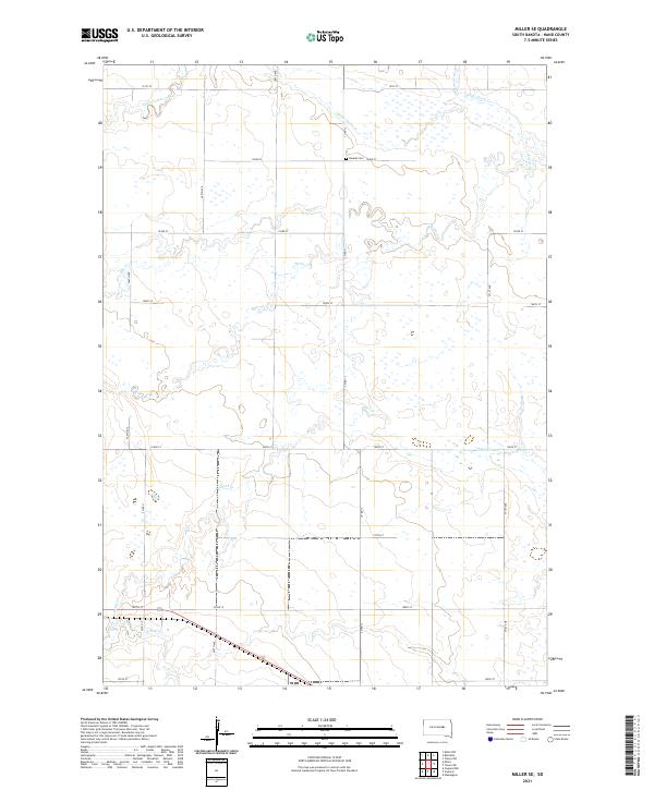
2021 Map of Miller SE
USGS Topo · Published 2021About this map
Beulah Cem sits at the intersection of Co Rd 13 and 192nd St, serving as a central point of reference in this rural Hand County landscape. This portion of the Great Plains is defined by a complex network of seasonal drainages and prairie wetlands. The hydrology is dominated by the winding paths of Little Turtle Cr and Turtle Cr in the northern and eastern reaches, while the southern section is drained by the multiple branches of Pearl Cr, including E Pearl Cr and W Pearl Cr. The land is surveyed into a strict section grid, with gravel roads like 367th Ave and Co Rd 19 facilitating movement through the agricultural terrain. The distribution of these watercourses suggests a landscape that oscillates between dry prairie and saturated wetlands depending on the season.
Find a feature on this map
26 named features on this map. Tap any name to fly to it.
Don’t see what you’re looking for? This feature index may not catch every label — zoom into the map to look around manually.
Map Details
Editions of this 2021 Miller SE Map
This is the sole edition of this map. No revisions or reprints were ever made.
Other maps of this area

1899 · Redfield
USGS Topo · 1:125,000

1950 · Vayland
USGS Topo · 1:24,000

1950 · Wessington
USGS Topo · 1:24,000

1950 · Vayland NW
USGS Topo · 1:24,000

1953 · Huron
USGS Topo · 1:250,000

1954 · Huron
USGS Topo · 1:250,000

1966 · Burdette
USGS Topo · 1:24,000

1967 · Tulare NW
USGS Topo · 1:24,000

1967 · Miller
USGS Topo · 1:24,000
1967 · Miller SE
USGS Topo · 1:24,000