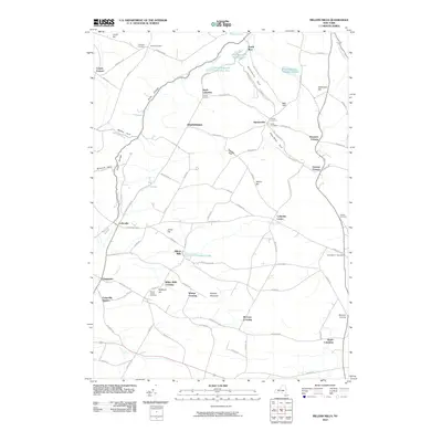
2010 Map of Millers Mills
USGS Topo · Published 2010About this map
Millers Mills and the surrounding highlands of Herkimer County define a landscape shaped by narrow valleys and local watercourses. The headwaters of the Unadilla River and its tributary at Unadilla Lake serve as focal points for historical settlement patterns, including Millers Mills Crossing and the nearby Cedarville Station. Numerous small crossroads and family-named landmarks like Dennison Corners and Getman Corners dot the plateau, reflecting the area's deep agricultural roots.
Find a feature on this map
96 named features on this map. Tap any name to fly to it.
Don’t see what you’re looking for? This feature index may not catch every label — zoom into the map to look around manually.
Map Details
Editions of this 2010 Millers Mills Map
This is the sole edition of this map. No revisions or reprints were ever made.
Other maps of this area

1898 · Utica
USGS Topo · 1:62,500

1900 · Little Falls
USGS Topo · 1:62,500

1900 · Utica
USGS Topo · 1:62,500

1903 · Richfield Springs
USGS Topo · 1:62,500

1903 · Little Falls
USGS Topo · 1:62,500

1907 · Winfield
USGS Topo · 1:62,500

1939 · Little Falls
USGS Topo · 1:62,500

1943 · Schuyler Lake
USGS Topo · 1:24,000

1943 · Utica East
USGS Topo · 1:24,000

1943 · Jordanville
USGS Topo · 1:24,000