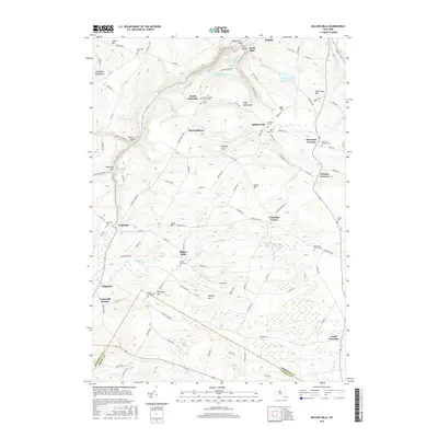
2016 Map of Millers Mills
USGS Topo · Published 2016About this map
The headwaters of the Unadilla River and the undulating uplands of southern Herkimer County define this landscape, where small rural hamlets remain connected by a web of historic county roads. The namesake settlement of Millers Mills sits near Unadilla Lake, serving as a focal point for the surrounding agricultural community. To the north, the terrain drops sharply into the Ilion Gorge, where the Ilion Reservoir Number One, Ilion Reservoir Number Two, and Ilion Reservoir Number Three manage the local water supply. For genealogists, the map is a significant resource, documenting numerous family and community burial grounds such as Litchfield Cem, Fulmer Cem, and the Brown-Young Cem. These landmarks, along with crossroads like Dennison Corners and Getman Corners, trace the long-standing settlement patterns of the region well into the twenty-first century.
Find a feature on this map
110 named features on this map. Tap any name to fly to it.
Don’t see what you’re looking for? This feature index may not catch every label — zoom into the map to look around manually.
Map Details
Editions of this 2016 Millers Mills Map
This is the sole edition of this map. No revisions or reprints were ever made.
Other maps of this area

1898 · Utica
USGS Topo · 1:62,500

1900 · Little Falls
USGS Topo · 1:62,500

1900 · Utica
USGS Topo · 1:62,500

1903 · Richfield Springs
USGS Topo · 1:62,500

1903 · Little Falls
USGS Topo · 1:62,500

1907 · Winfield
USGS Topo · 1:62,500

1939 · Little Falls
USGS Topo · 1:62,500

1943 · Schuyler Lake
USGS Topo · 1:24,000

1943 · Utica East
USGS Topo · 1:24,000

1943 · Jordanville
USGS Topo · 1:24,000