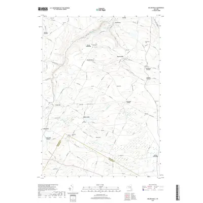
2019 Map of Millers Mills
USGS Topo · Published 2019About this map
The Unadilla River and its headwaters at Unadilla Lake define the central drainage of this landscape, carving through a series of prominent elevations including Monkey Mtn and Spoon Hill. The settlement pattern is characterized by numerous historic hamlets and crossroads, such as Millers Mills, Elizabethtown, and Columbia Center. To the north, the steep descent of the Ilion Gorge drops toward the Mohawk Valley, passing Ilion Reservoir Number Two. For genealogists and local historians, the area is notable for its dense concentration of family and community burial sites, including the Brown-Young Cem, Fulmer Cem, and Edick Cem. These small cemeteries, often associated with early churches like the North Columbia Church-Cem, provide a clear map of the 19th-century family lineages that established these Herkimer and Otsego County communities.
Find a feature on this map
106 named features on this map. Tap any name to fly to it.
Don’t see what you’re looking for? This feature index may not catch every label — zoom into the map to look around manually.
Map Details
Editions of this 2019 Millers Mills Map
This is the sole edition of this map. No revisions or reprints were ever made.
Other maps of this area

1898 · Utica
USGS Topo · 1:62,500

1900 · Little Falls
USGS Topo · 1:62,500

1900 · Utica
USGS Topo · 1:62,500

1903 · Richfield Springs
USGS Topo · 1:62,500

1903 · Little Falls
USGS Topo · 1:62,500

1907 · Winfield
USGS Topo · 1:62,500

1939 · Little Falls
USGS Topo · 1:62,500

1943 · Schuyler Lake
USGS Topo · 1:24,000

1943 · Utica East
USGS Topo · 1:24,000

1943 · Jordanville
USGS Topo · 1:24,000