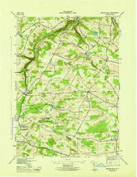
1945 Map of Millers Mills
USGS Topo · Published 1945About this map
Millers Mills and the headwaters of the Unadilla River anchor this mid-1940s survey of the borderlands between Herkimer and Otsego Counties. The landscape is defined by deep geological features like Passage Gulf and Polly Miller Gulf, which dictated the early settlement patterns of hamlets such as Columbia Center and Spinnerville. The northern portion of the map is dominated by the water infrastructure for the Mohawk Valley, showing Ilion Reservoir No 1 and Ilion Res No 2 tucked into the steep terrain of German Flatts. Genealogists will find a wealth of local landmarks, including the Conrad Helmer Cem and numerous district schoolhouses like the Bloodgood School. The southern edge is marked by the historic Cherry Valley Turnpike and the Delaware Lackawanna and Western railroad, illustrating the vital transportation corridors that linked these upland farming communities to the broader region.
Find a feature on this map
61 named features on this map. Tap any name to fly to it.
Don’t see what you’re looking for? This feature index may not catch every label — zoom into the map to look around manually.
Map Details
Editions of this 1945 Millers Mills Map
This is the sole edition of this map. No revisions or reprints were ever made.
Other maps of this area

1898 · Utica
USGS Topo · 1:62,500

1900 · Little Falls
USGS Topo · 1:62,500

1900 · Utica
USGS Topo · 1:62,500

1903 · Richfield Springs
USGS Topo · 1:62,500

1903 · Little Falls
USGS Topo · 1:62,500

1907 · Winfield
USGS Topo · 1:62,500

1939 · Little Falls
USGS Topo · 1:62,500

1943 · Schuyler Lake
USGS Topo · 1:24,000

1943 · Utica East
USGS Topo · 1:24,000

1943 · Jordanville
USGS Topo · 1:24,000