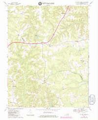
1968 Map of Millers Tavern
USGS Topo · Published 1985About this map
The boundary between King and Queen County and Essex County cuts across a landscape defined by an extensive network of wetlands and small agricultural settlements in the late 1960s. Millers Tavern serves as a central junction, surrounded by several smaller communities like Bruington, Powcan, and Howertons. The map reveals a high density of country churches and local schools, such as the John Moncure School, reflecting the social fabric of these rural Tidewater districts.
Find a feature on this map
56 named features on this map. Tap any name to fly to it.
Don’t see what you’re looking for? This feature index may not catch every label — zoom into the map to look around manually.
Map Details
Editions of this 1968 Millers Tavern Map
3 editions found
Other maps of this area

1918 · Tappahannock
USGS Topo · 1:62,500

1918 · Aylett
USGS Topo · 1:62,500

1919 · New Kent
USGS Topo · 1:62,500

1919 · Tappahannock
USGS Topo · 1:62,500

1920 · King William
USGS Topo · 1:62,500

1933 · Aylett
USGS Topo · 1:62,500

1943 · Richmond
USGS Topo · 1:250,000

1944 · Mount Landing
USGS Topo · 1:31,680

1944 · Tappahannock
USGS Topo · 1:31,680

1944 · Dunnsville
USGS Topo · 1:31,680