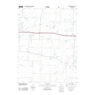
2012 Map of Millersburg
USGS Topo · Published 2012About this map
Stephens and Shaw anchor this portion of Boone County, Missouri, during a period of modern expansion along the Interstate 70 corridor. The landscape is defined by the headwaters of several significant drainages, including Gans Creek and Bonne Femme Creek, which flow through a mix of agricultural plots and residential developments. Local water management is evident through numerous reservoirs such as Landhuis Lake, Little Dixie Lake, and the specifically numbered Number 153 Reservoir.
Find a feature on this map
73 named features on this map. Tap any name to fly to it.
Don’t see what you’re looking for? This feature index may not catch every label — zoom into the map to look around manually.
Map Details
Editions of this 2012 Millersburg Map
This is the sole edition of this map. No revisions or reprints were ever made.
Other maps of this area

1886 · Jefferson City
USGS Topo · 1:125,000

1890 · Moberly
USGS Topo · 1:125,000

1894 · Jefferson City
USGS Topo · 1:125,000

1917 · Sturgeon
USGS Topo · 1:62,500

1935 · Columbia
USGS Topo · 1:24,000

1940 · Columbia
USGS Topo · 1:24,000

1944 · Millersburg
USGS Topo · 1:62,500

1945 · Centralia
USGS Topo · 1:62,500

1946 · Millersburg
USGS Topo · 1:62,500

1947 · Jefferson City
USGS Topo · 1:250,000