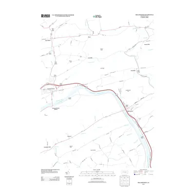
2013 Map of Millerstown
USGS Topo · Published 2013About this map
Millerstown and Thompsontown anchor this study of the Juniata River valley, where the legacy of nineteenth-century transportation is still clearly etched into the terrain. The Juniata River is flanked by the remnants of the Pennsylvania Canal, a vital corridor that once linked the Susquehanna to the west. This industrial heritage is mirrored by the presence of Thompsontown Station and the historic river crossing at Old Ferry, marking points where trade and travel intersected with the water. The landscape is deeply carved by smaller valleys and hollows, such as Potash Hollow and Little Pfoutz Valley, while significant ridges like Shellys Ridge and Raccoon Ridge define the local topography.
Find a feature on this map
99 named features on this map. Tap any name to fly to it.
Don’t see what you’re looking for? This feature index may not catch every label — zoom into the map to look around manually.
Map Details
Editions of this 2013 Millerstown Map
This is the sole edition of this map. No revisions or reprints were ever made.
Other maps of this area

1907 · New Bloomfield
USGS Topo · 1:62,500

1907 · Millerstown
USGS Topo · 1:62,500

1925 · Mifflintown
USGS Topo · 1:48,000

1930 · Loysville
USGS Topo · 1:62,500

1933 · Loysville
USGS Topo · 1:62,500

1934 · Mifflintown
USGS Topo · 1:62,500

1937 · Mifflintown
USGS Topo · 1:62,500

1943 · Millerstown
USGS Topo · 1:62,500

1943 · New Bloomfield
USGS Topo · 1:62,500

1950 · Harrisburg
USGS Topo · 1:250,000
Featured Places
- Millerstown, PA
- Thompsontown, PA
- Fayette Township, PA
- Tuscarora Township, PA
- Gramere, Tuscarora Township