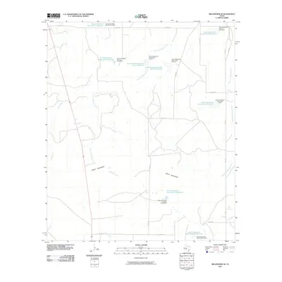
2010 Map of Millersview SE
USGS Topo · Published 2010About this map
The Brady Mountains anchor the southern reaches of this West Texas landscape, providing the topographic elevation that feeds a network of seasonal drainages. This high ground gives rise to Maverick Creek and Kelly Creek, while the broader terrain is defined by the forks of Mustang Creek. The map reveals an extensive mid-20th-century water management strategy, documented by numerous catchments such as the Soil Conservation Service Site 7 Reservoir and Soil Conservation Service Site 36 Reservoir. These structures, paired with their respective dams, illustrate the region's efforts to control erosion and manage runoff for ranching and agriculture. The drainage pattern of West Fork Mustang Creek and Duck Creek suggests a territory defined by expansive open spaces, where rural transit relies on routes like Ranch Rd and FM 2134.
Find a feature on this map
30 named features on this map. Tap any name to fly to it.
Don’t see what you’re looking for? This feature index may not catch every label — zoom into the map to look around manually.
Map Details
Editions of this 2010 Millersview SE Map
This is the sole edition of this map. No revisions or reprints were ever made.
Other maps of this area

1892 · Eden
USGS Topo · 1:125,000

1896 · Eden
USGS Topo · 1:125,000

1931 · Stacy
USGS Topo · 1:62,500

1954 · Brownwood
USGS Topo · 1:250,000

1967 · Millersview SE
USGS Topo · 1:24,000
1967 · Millersview
USGS Topo · 1:24,000
1967 · Doole SW
USGS Topo · 1:24,000
1967 · Mustang Creek
USGS Topo · 1:24,000
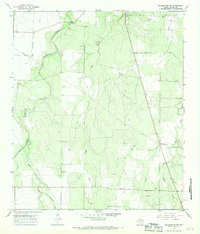
1967 · Millersview NW
USGS Topo · 1:24,000
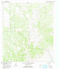
1967 · Millersview SW
USGS Topo · 1:24,000