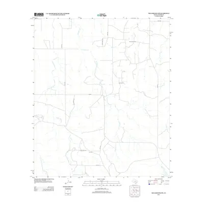
2012 Map of Millersview SW
USGS Topo · Published 2012About this map
Ellis Ranch and the industrial activity of the Speck Oil Field define this corner of Concho County during the early 2010s. The landscape is dominated by a complex network of seasonal drainage and ranch roads, where the diverging branches of Middle Kickapoo Cr and E Kickapoo Cr carve through the dry Texas terrain. In the northern section, the North Speck Oil Field sits near Hog Cr, illustrating the region's reliance on mineral extraction alongside traditional ranching operations.
Find a feature on this map
18 named features on this map. Tap any name to fly to it.
Don’t see what you’re looking for? This feature index may not catch every label — zoom into the map to look around manually.
Map Details
Editions of this 2012 Millersview SW Map
This is the sole edition of this map. No revisions or reprints were ever made.
Other maps of this area

1892 · San Angelo
USGS Topo · 1:125,000

1892 · Eden
USGS Topo · 1:125,000

1896 · Eden
USGS Topo · 1:125,000

1954 · Brownwood
USGS Topo · 1:250,000

1954 · San Angelo
USGS Topo · 1:250,000

1957 · Eola
USGS Topo · 1:62,500

1958 · San Angelo
USGS Topo · 1:250,000

1965 · San Angelo
USGS Topo · 1:250,000

1967 · Millersview SE
USGS Topo · 1:24,000
1967 · Millersview
USGS Topo · 1:24,000