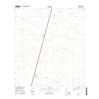
2016 Map of Millett
USGS Topo · Published 2016About this map
Millett and Gardendale serve as the primary nodes of human settlement in this South Texas landscape. The region is defined by a dendritic network of ephemeral waterways, including the winding Cibolo Cr and Slaughter Cr, which cut through the brush country. The map captures a moment in the mid-2010s where modern transportation corridors intersect with remnants of older industrial infrastructure. While the primary interstate corridor dominates the north-south transit, the presence of the Old Sausage RR Line near Gardendale hints at the area's agricultural and logistical history. Local ranching and residential life are represented by numerous named roads like Freddie Copps Rd and Ledwig Ranch Rd, as well as the Anderson Ranch Airport in the northern portion of the quadrangle.
Find a feature on this map
27 named features on this map. Tap any name to fly to it.
Don’t see what you’re looking for? This feature index may not catch every label — zoom into the map to look around manually.
Map Details
Editions of this 2016 Millett Map
This is the sole edition of this map. No revisions or reprints were ever made.
Other maps of this area

1927 · Bart
USGS Topo · 1:62,500

1929 · Cotulla
USGS Topo · 1:125,000

1940 · Cotulla
USGS Topo · 1:62,500

1940 · Artesia Wells
USGS Topo · 1:62,500

1942 · Dilley
USGS Topo · 1:62,500

1953 · Crystal City
USGS Topo · 1:250,000

1955 · Crystal City
USGS Topo · 1:250,000

1956 · Woodward
USGS Topo · 1:62,500

1961 · Crystal City
USGS Topo · 1:250,000

1968 · Crystal City
USGS Topo · 1:250,000