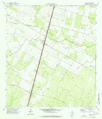
1974 Map of Millett
USGS Topo · Published 1977About this map
The Missouri Pacific railroad forms the central spine of this South Texas landscape, dictating the placement of settlements and local industry in the mid-1970s. The town of Millett sits as a primary node along the tracks, characterized by a concentration of wells and a small Cem to the west. Farther south, the rail line reaches Gardendale, another small community situated on the flat plains of La Salle County. This era reveals a rural economy heavily reliant on subterranean resources, evidenced by the numerous water wells and a large Gravel Pit positioned near the tracks.
Find a feature on this map
10 named features on this map. Tap any name to fly to it.
Don’t see what you’re looking for? This feature index may not catch every label — zoom into the map to look around manually.
Map Details
Editions of this 1974 Millett Map
This is the sole edition of this map. No revisions or reprints were ever made.
Other maps of this area

1927 · Bart
USGS Topo · 1:62,500

1929 · Cotulla
USGS Topo · 1:125,000

1940 · Cotulla
USGS Topo · 1:62,500

1940 · Artesia Wells
USGS Topo · 1:62,500

1942 · Dilley
USGS Topo · 1:62,500

1953 · Crystal City
USGS Topo · 1:250,000

1955 · Crystal City
USGS Topo · 1:250,000

1956 · Woodward
USGS Topo · 1:62,500

1961 · Crystal City
USGS Topo · 1:250,000

1968 · Crystal City
USGS Topo · 1:250,000