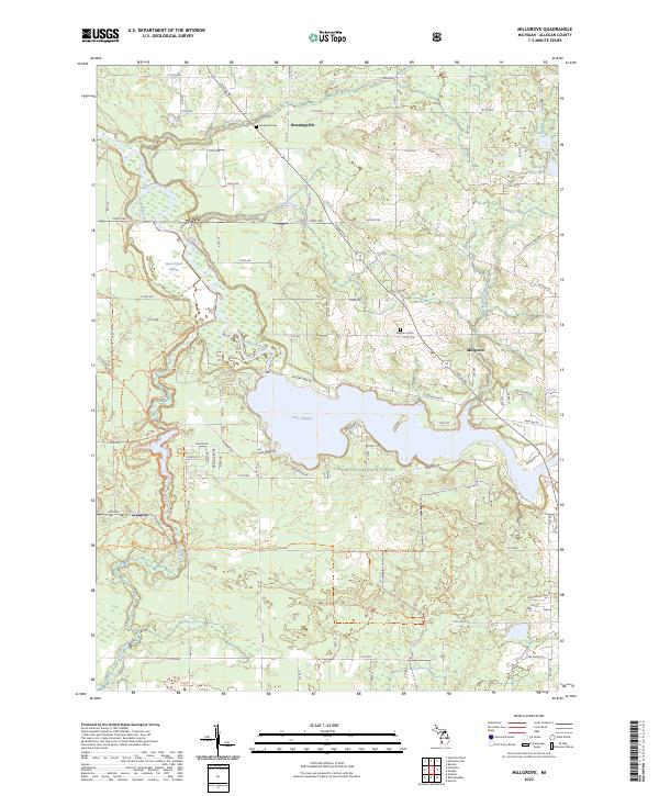
2023 Map of Millgrove
USGS Topo · Published 2023About this map
Lake Allegan dominates the central landscape of this western Michigan survey, where the Kalamazoo River flows through a mix of managed timberland and small rural settlements. The area is characterized by significant public land holdings, including portions of the Manistee National Forest and the Swan Creek Marsh, reflecting a region deeply tied to conservation and river-based recreation. Local history is anchored by the small communities of Millgrove and Dunningville, each with its own local burying ground, Millgrove Cem and Brookside Cem. The map reveals a dense network of sectional roads like Allegan Rd and Lincoln Rd that grid the terrain around winding water bodies such as Bear Creek and Sand Creek. Toward the northeast, the smaller Big Spec Lake and Little Spec Lake provide more intimate landmarks within the larger hydrological system of the Palmer Bayou.
Find a feature on this map
54 named features on this map. Tap any name to fly to it.
Don’t see what you’re looking for? This feature index may not catch every label — zoom into the map to look around manually.
Map Details
Editions of this 2023 Millgrove Map
This is the sole edition of this map. No revisions or reprints were ever made.
Other maps of this area

1927 · Bangor
USGS Topo · 1:62,500

1928 · Fennville
USGS Topo · 1:62,500

1931 · Fennville
USGS Topo · 1:62,500

1931 · Bangor
USGS Topo · 1:62,500

1943 · Bangor
USGS Topo · 1:62,500

1946 · Gobles
USGS Topo · 1:62,500

1948 · Gobles
USGS Topo · 1:62,500

1949 · Gobles
USGS Topo · 1:62,500

1958 · Allegan
USGS Topo · 1:62,500

1958 · Racine
USGS Topo · 1:250,000
Featured Places
- Trowbridge Township, MI
- Valley Township, MI
- Monterey Township, MI
- Allegan Township, MI
- Cheshire Township, MI