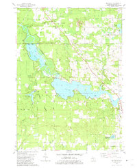
1981 Map of Millgrove
USGS Topo · Published 1981About this map
Allegan Lake and the winding Kalamazoo River dominate this landscape within the Allegan State Game Area. The settlement of Millgrove serves as a focal point near the eastern boundary, while Dunningville sits to the north along the Railroad. This 1981 survey illustrates a region defined by its water resources and conservation land, featuring extensive wetlands like Swan Creek Marsh and Koopman Marsh.
Find a feature on this map
58 named features on this map. Tap any name to fly to it.
Don’t see what you’re looking for? This feature index may not catch every label — zoom into the map to look around manually.
Map Details
Editions of this 1981 Millgrove Map
This is the sole edition of this map. No revisions or reprints were ever made.
Other maps of this area

1927 · Bangor
USGS Topo · 1:62,500

1928 · Fennville
USGS Topo · 1:62,500

1931 · Fennville
USGS Topo · 1:62,500

1931 · Bangor
USGS Topo · 1:62,500

1943 · Bangor
USGS Topo · 1:62,500

1946 · Gobles
USGS Topo · 1:62,500

1948 · Gobles
USGS Topo · 1:62,500

1949 · Gobles
USGS Topo · 1:62,500

1958 · Allegan
USGS Topo · 1:62,500

1958 · Racine
USGS Topo · 1:250,000