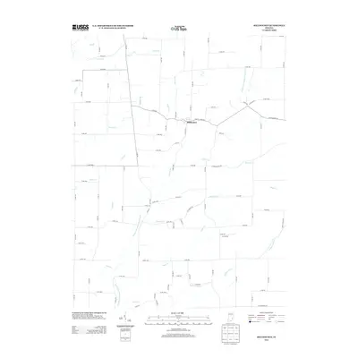
2013 Map of Millhousen
USGS Topo · Published 2013About this map
Millhousen serves as the central hub for this rural Decatur County landscape, where a dense network of county roads intersects with the natural drainage patterns of southeastern Indiana. The Vernon Fork Muscatatuck River meanders through the western portion of the area, joined by numerous tributaries including Sugar Cr, Wolf Cr, and Rock Cr. This 2013 survey illustrates the modern agricultural layout, showing how road systems like Co RD-700 and Co RD-1000s have been structured around the winding paths of Flatrock Cr and Leatherwood Cr. Further east, Lock Spring provides a distinct local landmark in a terrain defined by its watercourses, such as Honey Cr and Square Run, which continue to shape the local geography and land use in this part of the state.
Find a feature on this map
49 named features on this map. Tap any name to fly to it.
Don’t see what you’re looking for? This feature index may not catch every label — zoom into the map to look around manually.
Map Details
Editions of this 2013 Millhousen Map
This is the sole edition of this map. No revisions or reprints were ever made.
Other maps of this area

1942 · Columbus
USGS Topo · 1:125,000

1946 · Versailles
USGS Topo · 1:24,000

1946 · Osgood
USGS Topo · 1:24,000

1946 · New Point
USGS Topo · 1:24,000

1953 · Cincinnati
USGS Topo · 1:250,000

1957 · Cincinnati
USGS Topo · 1:250,000

1957 · Butlerville
USGS Topo · 1:24,000

1958 · Greensburg
USGS Topo · 1:24,000

1958 · Millhousen
USGS Topo · 1:24,000

1958 · Westport
USGS Topo · 1:24,000