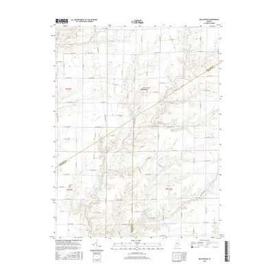
2016 Map of Millhousen
USGS Topo · Published 2016About this map
Millhousen stands as a primary settlement in this agricultural landscape where Decatur, Ripley, and Jennings counties meet. The area is defined by a dense network of watercourses, including the Vernon Fork Muscatatuck River and major tributaries like Cobbs Fork, Flatrock Cr, and Sugar Cr. These streams carve through the rural countryside, dictating the placement of county roads such as Millhousen Rd and W Millhousen Rd which connect the scattered farmsteads. Genealogical interest is anchored by the Cornell Cem, located in the southwest near the winding path of Panther Cr. The map reveals a transition in terrain from the more established township grids of t9n r9e to the dissected stream valleys in the east and south, showcasing the persistent rural character of this Indiana tri-county border region in the early 21st century.
Find a feature on this map
95 named features on this map. Tap any name to fly to it.
Don’t see what you’re looking for? This feature index may not catch every label — zoom into the map to look around manually.
Map Details
Editions of this 2016 Millhousen Map
This is the sole edition of this map. No revisions or reprints were ever made.
Other maps of this area

1942 · Columbus
USGS Topo · 1:125,000

1946 · Versailles
USGS Topo · 1:24,000

1946 · Osgood
USGS Topo · 1:24,000

1946 · New Point
USGS Topo · 1:24,000

1953 · Cincinnati
USGS Topo · 1:250,000

1957 · Cincinnati
USGS Topo · 1:250,000

1957 · Butlerville
USGS Topo · 1:24,000

1958 · Greensburg
USGS Topo · 1:24,000

1958 · Millhousen
USGS Topo · 1:24,000

1958 · Westport
USGS Topo · 1:24,000