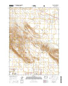
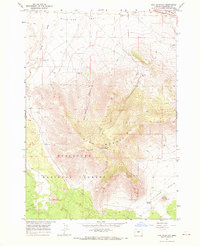
2014 Map of Millican SE
USGS Topo · Published 2014About this map
Deschutes National Forest land dominates the southwestern portion of this high-desert landscape in central Oregon, where the volcanic topography is defined by the significant rise of Pine Mtn. The terrain is marked by distinct geological depressions and ridges, including the Kotzman Basin and Pine Ridge, which contrast with the drainage of the intermittently dry Dry River corridor to the north. Transportation through this arid region follows historical paths, most notably Us-20, which cuts across the northern section of the map near the Whitaker Holes. Secondary routes like Fox Butte Rd and Moffitt Rd provide access through the open range and forest boundaries, illustrating the modern management of this expanse of public land and the preservation of its natural relief features.
Find a feature on this map
14 named features on this map. Tap any name to fly to it.
Don’t see what you’re looking for? This feature index may not catch every label — zoom into the map to look around manually.
Map Details
Editions of this 2014 Millican SE Map
This is the sole edition of this map. No revisions or reprints were ever made.
Other maps of this area

1955 · Crescent
USGS Topo · 1:250,000

1957 · Crescent
USGS Topo · 1:250,000

1958 · Crescent
USGS Topo · 1:250,000

1966 · Millican SE
USGS Topo · 1:24,000

1967 · Brothers NW
USGS Topo · 1:24,000
1967 · Brothers SW
USGS Topo · 1:24,000
1967 · West Butte
USGS Topo · 1:24,000
1967 · Millican
USGS Topo · 1:24,000
1967 · Pine Mountain
USGS Topo · 1:24,000

1970 · Crescent
USGS Topo · 1:250,000