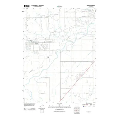
2010 Map of Milliken
USGS Topo · Published 2010About this map
The confluence of the South Platte River and the Big Thompson River anchors this 2010 landscape, where the agricultural economy is etched into the earth through an extensive network of irrigation works. Numerous canals and ditches, such as the Western Mutual Ditch, Union Ditch, and Farmers Independent Ditch, weave between the established towns. The rail-aligned settlements of Milliken and Gilcrest serve as the primary hubs, surrounded by smaller historical siding locations and rural communities like Peckham, Dent, Adna, and Houston. Local landmarks including Wildcat Mound and several small bodies of water like Spomer Lakes and Kammerzell Lake provide points of reference across the grid. This survey documents the persistent reliance on water management systems to sustain the high plains farmland of Weld County, revealing the intricate layout of county roads that connect these agricultural interests.
Find a feature on this map
56 named features on this map. Tap any name to fly to it.
Don’t see what you’re looking for? This feature index may not catch every label — zoom into the map to look around manually.
Map Details
Editions of this 2010 Milliken Map
This is the sole edition of this map. No revisions or reprints were ever made.
Other maps of this area

1902 · Greeley
USGS Topo · 1:125,000

1949 · Gowanda
USGS Topo · 1:24,000

1949 · Platteville
USGS Topo · 1:24,000

1950 · Greeley
USGS Topo · 1:24,000

1950 · Gowanda
USGS Topo · 1:24,000

1950 · Platteville
USGS Topo · 1:24,000

1950 · Windsor
USGS Topo · 1:24,000

1950 · Johnstown
USGS Topo · 1:24,000

1950 · Bracewell
USGS Topo · 1:24,000

1950 · Milliken
USGS Topo · 1:24,000