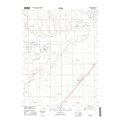
2016 Map of Milliken
USGS Topo · Published 2016About this map
The South Platte River corridor south of Evans defines this landscape, where a sophisticated network of historical irrigation infrastructure has supported Weld County agriculture for generations. Early water management is visible through the Loveland and Greeley Canal, the Farmers Independent Ditch, and the Union Ditch, which redirect water across the plains to support settlements like Milliken and Platteville. The geography is further shaped by the confluence of the Big Thompson River and Little Thompson River near Hillsboro. Beyond the larger towns, smaller rail-aligned locations such as Peckham, Dent, and Gilcrest illustrate the transportation-dependent growth of the region. Distinctive landmarks like Wildcat Mound rise above the river valley, while the Jackrabbit Strip provides a localized reference point north of the river bends.
Find a feature on this map
68 named features on this map. Tap any name to fly to it.
Don’t see what you’re looking for? This feature index may not catch every label — zoom into the map to look around manually.
Map Details
Editions of this 2016 Milliken Map
This is the sole edition of this map. No revisions or reprints were ever made.
Other maps of this area

1902 · Greeley
USGS Topo · 1:125,000

1949 · Gowanda
USGS Topo · 1:24,000

1949 · Platteville
USGS Topo · 1:24,000

1950 · Greeley
USGS Topo · 1:24,000

1950 · Gowanda
USGS Topo · 1:24,000

1950 · Platteville
USGS Topo · 1:24,000

1950 · Windsor
USGS Topo · 1:24,000

1950 · Johnstown
USGS Topo · 1:24,000

1950 · Bracewell
USGS Topo · 1:24,000

1950 · Milliken
USGS Topo · 1:24,000